
CANADIAN GEOGRAPHIC
Canadian Geographic Magazine has featured detailed maps of Canada and the world for more than 80 years. Since 2011, AS THE CROW FLIES CARTOGRAPHY has been the Cartography firm behind Canadian Geographic‘s maps.
Canadian Geographic Magazine MapsWorking for the magazine takes us on journeys around the globe each and every month. We are proud to be the lead cartographers for Canadian Geographic Magazine, a national treasure.
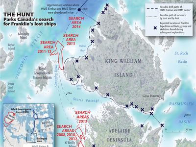
To view examples of maps we produce for Canadian Geographic Magazine and & Canadian Geographic Travel please view our Map Gallery - Canadian Geographic Maps |
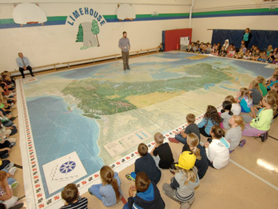
Giant Floor MapsThese maps are HUGE! At 26' x 36' they fill a school gymnasium and are designed with kids in mind. Walk, roll, play on these maps! Teacher kit included to enhance the learning experience.
See more detail below... |
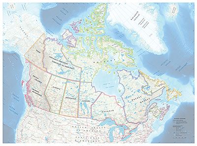
Posters & Tiled Maps
Posters - Bigger than a magazine map, yet smaller than the gymnasium sized maps, these little gems are ‘war room maps’. Unfold, put on a table and take some time to enjoy the read.
DIY Tiled Maps - Great for the classroom and absolutely free of charge, download these Tiled Maps and assemble yourself to use as a educational resource. More details below... |
Giant Floor Maps
|
AVAILABLE TO ALL EDUCATIONAL INSTITUTIONS ACROSS CANADA, Canadian Geographic now has 6 giant floor maps to loan. AS THE CROW FLIES CARTOGRAPHY is proud to create these maps and offer our educators a hands on and creative way to help share Canada's rich history.
These maps are available for a 3 week period through-out the school year and by special request during the summer months. Activity Trunk included (Learning Materials & Teacher's Guide) Map Dimensions: 10.7 m (35') x 7.9 m (26') Diameter of Shipping tube: 32 cm (13") Activity Trunk: 82 cm (32") x 46 cm (18") x 58 cm (22.5") To Order: Please visit Canadian Geographic's website and click on 'Request Now" |
|
Available Themes:
Arctic Alive
|
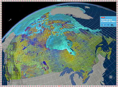
Canada from Space
|
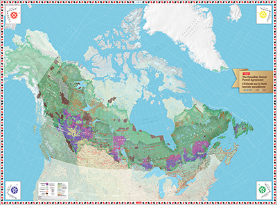
The Canadian Boreal Forest
|
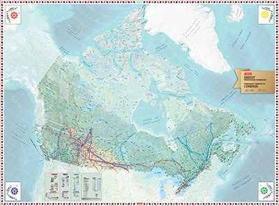
Energy Production & Transmission
|
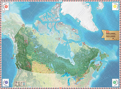
Parks Canada
|
Wild Migrations
|
DIY Tiled Maps
Great for any educational institution or learning environment, Canadian Geographic Education (the educational branch of the Royal Canadian Geographical Society) teamed up with AS THE CROW FLIES CARTOGRAPHY to bring you FREE tiled maps.
Not enough room for a giant floor map? These tiled maps can be printed in separate pieces and arranged together in your very own classroom.
Free maps! How cool is that?
Not enough room for a giant floor map? These tiled maps can be printed in separate pieces and arranged together in your very own classroom.
Free maps! How cool is that?
|
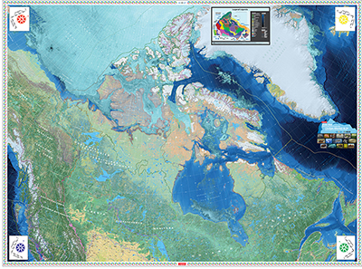
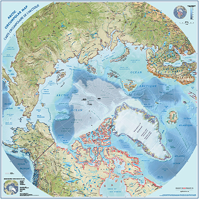
Arctic Circumpolar Tiled Map
Help students gain a new perspective of the world with this Arctic Circumpolar tiled map. Designed to encourage exploration and discovery of a place that many Canadians haven’t visited, this 36-page map highlights the North Pole and all oceans and countries surrounding it. Teachers of all grade levels are encouraged to use this map to help students explore Canada’s Arctic from a political, environmental, cultural and geographical perspective. |
|
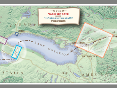
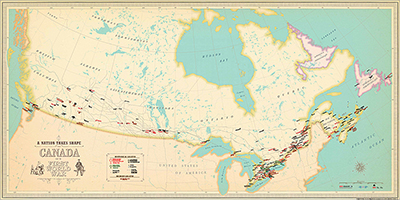
First World War
The First World War affected the lives of millions of Canadians and 100 years later the changes it wrought across Canada are still being felt. This map and educational package is designed to take students back to the turn of the 20th century, a time when Canada was still a Dominion, Newfoundland was a separate entity, and women couldn’t vote. You can print the 24 pages of the map in either colour or black and white. When you assemble the map and follow the 10 associated activities, your students will discover the major transportation routes, training facilities, internment camps, wartime hubs, the role of women during the war and more. |
Coming soon... Tiled maps of each province and territory.
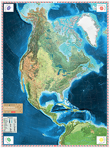
Canadian Geographic Magazine Maps
To view examples of maps we produce for Canadian Geographic Magazine and & Canadian Geographic Travel please view our Map Gallery - Canadian Geographic Maps
Tell your story, your way with a professionally designed map.
Contact us today for your free quote.
Contact us today for your free quote.

Have a question about your mapping needs?
Ask us, we'll get back to you right away! |
|
|
Mailing Addres:
As the Crow Flies Cartography PO Box 185 Georgetown PO Main, ON L7G 4T1 CANADA 905.702.9080 [email protected] |